About Coconino County

About Coconino County

Encompassing 18,661 square miles, Coconino County, Arizona, is the second largest county in the U.S. but one of the least populated. Our county includes Grand Canyon National Park, the Navajo, Havasupai, Hualapai and Hopi Indian Reservations, and the largest contiguous ponderosa pine forest in the world. Elevations range from 2,000 feet above sea level along the Colorado River to 12,633 feet at the summit of Mt. Humphreys in Flagstaff.

Disclosure: Some of the links on this site are affiliate links, and I may earn a commission if you click through and make a purchase.

Showing posts with label Training. Show all posts

Over The Edge: Technical Rescue Simulations

Most of us didn't know this would be a simulation instead of just a regular training session—not until we got to the site and were suddenly given a briefing and our initial assignments. But as flustered as I was at first, I'm glad we did this and hope we'll do more mock technical rescues in the near future. Putting skills together under pressure—and, simulated or not, I definitely felt the pressure—is a good way to test yourself and the team, to really see where improvement and more practice is needed.

So, there were two victims over the edge following a car crash (drunk driving, I heard). This was considered "steep-angle" terrain, not low-angle and not high-angle (a cliff) either. The footing was precarious, with loose rocks all over—a significant hazard for both rescuers and victims below—which is why one of the victims got up and moved when I started coming down with the first litter, dislodging rocks as I went. Definitely something I need to pay more attention to and not descend directly above anyone. BIG note made to self on that one!

Matter of fact, my notes to self during yesterday's exercise (well, exercises, because we did more than one) could have filled several notebook pages if I'd written them all down. They included things like, "Practice, practice, practice your knots, Deb," and "When on a steep-angle raise, attach a prusik from my harness to either the main line or belay line and another from my harness to the litter, then lean back. Let the haulers do the work and don't try to lift the litter." Boy, did I learn that second thing the hard way!

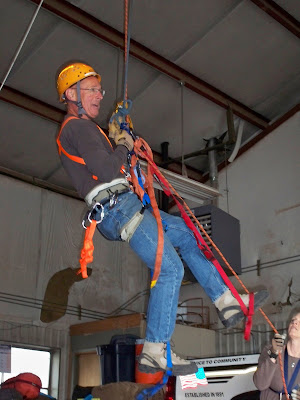
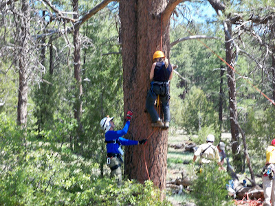
Here are some photos from the day's first exercise:

As part of the hasty team, Sueanne (in black) prepares to rappel down to one of the two patients to asses his condition. Meanwhile, another member of the hasty team (not in the picture) rappels to the second patient...


Robert sets up a wrap three/pull two anchor for a raising system...


Scott works the 540 belay....


And in other news...

It looks like I'll be attending a seven-day Ropes That Rescue Mountain Rescue Workshop in Sedona in February. I definitely need to have my knots down pat by then!

Snow Play SAR Style

It was kind of funny. There we are, riding around (and around and around) on snowmobiles and in the snowcat and the vehicle with the Mattracks, while families with children are sledding and building snowmen and igloos in our midst. Besides "Don't break anything," the big rule of the day was "Don't squash any kids." I'm happy to report we didn't do either one.

But there were no families with kids around when we first got to our training area on Saturday, just some campers who'd spent the night near the cellphone tower. Our rather large group of SAR folks, Forest Service personnel, and deputies interrupted their morning solitude when we arrived our contingent of cars, trucks, and "snow play equipment" and proceeded to divide ourselves into groups for the various stations. In addition to the snow machines, we also had a snowshoeing and winter gear review station.

It was a fun day. I enjoyed seeing my teammates after quite a long stretch without any missions. I also learned some new things. And I got past—though not over—my fear of loading and unloading the snowcat from its trailer. (Thanks for not letting me back out, Sergeant D.) Darn, I wish I had pictures of how the snowcat trailer works, but I forgot my camera that day.

Suffice it to say,when I climbed into the driver's seat, my experienced teammate on the passenger side yelled, "Hey, anybody know if the airbags are workin' in this thing?" (No, there ARE no air bags in a snowcat.) But I think I did a pretty okay job of it. After all, I didn't dump the beast off the side of the trailer. I trusted my teammates—the one in the vehicle with me and the one out front—to guide me through it. And I managed to pull it off with only one "duh" moment. ("Why isn't this thing moving forward? I asked. And my teammate replied, "Because you have to put your foot on the gas." Yeah... I knew that. I was just nervous, you see.)

Trust, though... that's something we talked about briefly on the drive back to the SAR building. It's a really good feeling to have people around who you know you can rely on, who have your best interest and safety at heart and care about what happens to you. To me, it doesn't matter that I see most of these folks just during SAR missions, trainings, and meetings; I still trust them with my life — like when I rappel over the edge during tech training. If a teammate I trust has safety-checked everything, I feel as secure as possible (which will never be completely secure) and know that things will be okay.


Wilderness First Responder

I was nearing the end of my one-year grace period for getting my Wilderness First Responder (WFR) recertification. If I didn't recertify in time, I'd have to take the full 80-hour course all over again (for a third time) to get that WFR card, so I signed up for a two-day Wilderness First Aid (WFA) class, held this past weekend at the law enforcement complex here in Flagstaff. The WFA class can be used in place of the standard three-day WFR recert course, with a written test and practical exam tacked onto the normal WFA curriculum.

So, what is all this WFR and WFA stuff, you ask, and does a volunteer have to be certified in one or the other to participate with search and rescue?

As for the second question, no. At least not here in Coconino County. SAR volunteers are not required to have medical training—though many do, including some EMTs, paramedics, and nurses on the team—and we're limited to Basic Life Support (BLS) as far as the medical care we can give in the backcountry, along with some splinting. But I'm sure this varies among SAR teams.

In my case, I haven't had the opportunity to use much of what I've learned in WFR courses "for real" in the field. Yet. But I feel better having the training in case I ever do need to make use of it, either in SAR or as a recreational hiker if I come across someone who's injured or ill in the backcountry. And, by "backcountry" I mean more than one hour from definitive medical care. That's the line used to differentiate between wilderness and urban medicine. With the number of SAR missions I go on and the amount of hiking I do on my own, chances are that, sooner or later, I'll have to put that WFR training to use.

Even if you're already an EMT, paramedic, nurse, or doctor, if all of your training is in urban medical care, I think some wilderness medical training would be great to have if you ever work or travel in the backcountry. This is because the backcountry environment means extended contact with a patient, whose condition and needs may change over time. It also means less-than-ideal conditions, like heat and cold, rain and wind, altitude and darkness, all of which can lead to increased stress on you, the rescuer. Improvisation is another thing that also goes hand-in-hand with wilderness medicine, when we often have only the gear on our backs and maybe a patient's gear to use to treat and splint.

A great book that really drives home the conditions faced by wilderness medical providers is Mountain Rescue Doctor: Wilderness Medicine in the Extremes of Nature by Christopher Van Tilberg, a member of Oregon's Crag Rats SAR team. You can read my review of the book in Wilderness Survival and Rescue Reading.

As far as wilderness medicine classes, here are general course descriptions:

Wilderness First Aid
is a fast-paced, 16- to 24-hour class given over two or three days, covering a wide range of wilderness medicine topics for people who travel and work in the outdoors. Half the class time is spent completing practical skills, case studies, and scenarios, so students aren't just sitting and listening to an instructor the whole time but are instead putting their new skills to use constantly.

The next step up from WFA is the 40-hour Wilderness Advanced First Aid, a five-day class focusing on stabilization, treatment, and evacuation guidelines of patients in backcountry environments. There's more emphasis on long-term patient care and specific injury evaluation than in the WFA class.

The Wilderness First Responder course is an 80-hour curriculum designed to provide students with "the tools to make critical medical and evacuation decisions in remote locations"(NOLS). Like WFA, WFR students are constantly practicing their skills by participating in scenarios and case studies. Adult & Child CPR is also included in this course.

And then there's Wilderness EMT certification (W-EMT), the highest level of wilderness medicine training available. This is a 180-hour, month-long class that combines wilderness medicine with urban medical care practices, including time at a hospital and in an ambulance.

I took my first WFR class in 1996 with SOLO and my second 80-hour course as well as recert through the Wilderness Medicine Institute, a branch of the National Outdoor Leadership School.

Trusting My Gear and My Teammates

Have I mentioned that I'm a bit afraid of heights? Well, make that afraid of "exposure" more like. Either way, being suspended 100 feet above the ground between two sides of a canyon isn't exactly within my comfort zone. 

But that's where I found myself on Saturday, with some of my technical rescue teammates on one side of the canyon at Paradise Forks, lowering me, and the others on the opposite side, raising. There was a main line and a belay line on either side, with me somewhere in the middle, hanging while attached to all four ropes.

I could have said no. More than one of my teammates said, "Deb, if you don't feel comfortable with this, no problem. You don't have to do it."  I may have hesitated at that suggestion for a split second, but I said, "No, I'm fine with it."

I tried my best to look and sound at ease. Besides, it's better I do it—go over the edge—as much as possible, to get more comfortable with the skills and with the feeling of trusting my life to gear and teammates.

And I couldn't be safer than with SAR. We do things carefully, with redundancy and with safety checks. As I was tying into the main and belay lines, a teammate was watching closely. Then I was checked over by three other experienced people—everything from my seat and chest harnesses to my caribiners and knots. The safety officer for the exercise also checked all anchors and main line and belay setups. Then, when all team members were ready, I walked off the edge. Wheeee!

Truth be told, it was actually quite fun. A teammate later told me I had a bit of a "newborn giraffe" look when I was temporarily set down on a pinnacle around mid-canyon, but I soon got my feet under me and stood up on my own. Then I was once again lifted and brought the rest of the way across the canyon. It turned out to be a very smooth ride.

One very useful, real-world example of how this maneuver would come in handy would be if, say, a victim were stranded on some sort of pinnacle like the one where I was briefly set down or on the top of a vehicle trapped in swiftwater. A rescuer could be lowered and suspended to a point somewhere between two stable sides, to where the victim is located, do a pick-off or package a patient in a litter, and then be raised along with that victim to either side.

This Saturday's tech team practice also included working with a guiding line, used to keep rescuer and rescue-ee away from rock walls and obstacles, making the lower and raise easier on both. I thought these setups were pretty fascinating, and I was excited to be part of them and to find that I could actually be useful. By George, I'm learnin' me stuff!

I've honestly been nervous that I wouldn't remember some of the basics when we'd move on to more advanced skills, even though I've been practicing those basics on the side. But I now realize that the basics come into play all the time. They're a foundation for the more advanced skills, so I get to use them even as we advance to more complex maneuvers. I find this all pretty exciting, though I still not have the nerves. And maybe that's a good thing. Getting too comfortable can lead to errors, so I've heard and read.

Other than training, we've also had a couple of call-outs. One ended quickly when a teammate who responded directly to the last known point (LKP) because he lives nearby, found the subject soon after he started searching. Not a happy ending, I'm afraid.

Then, last night, our team was called to assist Navajo PD in locating an overdue hunter on the reservation. The man was found... well, he found us... and was just fine. In fact, he was wondering who we were all looking for. Just a case of miscommunication with the reporting party, so it seems.

Oh, and finally (for now), on a recreational note: I recently went on a great hiking and car-camping trip to northern Arizona and southern Utah in the Paria-Vermillion Cliffs Wilderness Area, where I visited a place called White Pocket and the now internationally known Wave. Here's one of the many photos I took of the Wave before my camera went kaput (again):


If you want to see more of my pics and read an article I wrote about the hike, see Hiking The Wave In Coyote Buttes.

Now off to replenish the snack supply in my 24-hour pack before our next call-out.

Basic SAR Academy: The Final Exam

Twenty-four new members have now been added to our general SAR team following yesterday's final exam, a mock search and rescue in the Walnut Canyon area near Flagstaff. 

The call-out came at about 10:30 a.m. on Saturday, when students, experienced team leaders, and other current members responded to the SAR building, as they would for a real call-out.

Once everyone was assembled and the gear loaded, our captain, Howard (pictured here), made sure everyone was accounted for. We were then briefed by our coordinator and divided into field teams before heading to the staging area.


Our coordinator, who would be acting as IC (incident command) along with our captain, had no idea where the two lost subjects were located. Only the subjects, who were also volunteers from our team, and one other member knew their location. 

When we arrived at the staging area at the subjects' PLS (point last seen), we team leaders were given our assignments and then relayed that information to the rest of our field team. Team leaders were all experienced SAR members whose job it was to answer students' questions and make suggestions to "keep the ball in play." But it was up to the new folks to work together and figure things out while navigating and using the radio to communicate with IC and with other teams.

In this photo, my team hikes part of the Arizona Trail, calling the subjects' names, blowing whistles, and interviewing passing hikers, horseback riders, and mountain bikers. They also looked for boot tracks going off the main trail.


Eventually, another field team located the reporting party—one of the two missing hikers—who'd left his injured companion and climbed up out of the canyon to get a cellphone signal to call for help. Since the initial call, his cellphone battery had died, preventing any further communication. And he'd been lost, he said, at the time he called.

This one subject, while still confused about where he was, was able to give some details that helped the team locate the second subject at the bottom of the canyon. A (real) witness description from a child hiking with her parents also helped the team find the injured hiker.

Once the second subject was located, other field teams converged at that location, including the evac team with the litter and other medical equipment.


Then, the new members splinted the patient's (fake) broken ankle and were shown how to package her in the litter. Everyone had a chance to help carry the patient out.


Kay was such a good sport! She and Jerry, the other lost subject, had to sit around a long time before they were found. At least it was a warmer-than-usual fall day.


Despite some confusion with radio communication, which is to be expected with so many field teams and new members, things went really well.

I wish we always had this many people to carry a litter!


We finished up the mission and were back at the SAR building around 6:30 p.m.

Later that night, there was a real call-out at 8:00. That one, for an injured hiker on Mt. Agassiz, was canceled after about five minutes, when the hiker made it to the parking lot and refused further assistance.

There was another call at 4:00 this morning. That call was also canceled, but not before about 15 volunteers, both new and not, responded to the SAR building and loaded gear.

Hopefully, the turnout will continue to be that good.

SAR City

I'm back. And, hopefully, I'm now a better tracker after an another 16 hours of instruction, this time at the SAR City conference in Barstow, California, where there were more than 50 classes offered on a wide range of topics and skills. This annual conference is organized and hosted by the all-volunteer Barstow Desert Rescue Squad in San Bernadino County.

I thought the three-day event was well worth the trip, and as always, I really enjoyed meeting people from other teams, especially the folks from Dolores, Colorado, K9 Search & Rescue, who came over to introduce themselves soon after I arrived as I sat alone by my tent. So, thank you Shawn, Chuck, Randy, Vicki #1, Vicki #2, and Kimberly (and Jack!) for hanging out with me over the weekend. It was great to meet you and learn about your team. And it was nice meeting you too, Orange County guys. That's a spiffy Hummer you've got there.

As for that tracking class—which was excellent in many ways, and the lead instructor, retired sergeant and SAR coordinator Darryl Heller was top-notch—it's always interesting to learn the same skills from different people. I pick up new techniques and "tricks" and get at least a somewhat different perspective, which I think is really valuable. 

That said, it's a challenge not to say "yes, but.." when an instructor tells you that what you learned from someone else is wrong ("No, you never do that" was the reply to a question I asked about a method of measuring stride that I'd been taught at the Heber, Arizona conference), or if that instructor has a very different way of doing something than you're used to.

Not that I'm the greatest tracker after just two years in SAR and five tracking classes, but it can also be difficult to swallow your pride when someone talks to you like you have no experience at all. In my case, during one of the field sessions, I was used as an example of what NOT to do, even though it's something my own team does when tracking, and I've learned it from others as well. I must admit, that really bugged me... even after the field instructor came up to me after class to say it had been he who'd encouraged the other students in my group to do something that obliterated part of the track and that I hadn't actually done anything wrong. Well, phooey, I wish the other students knew that.

Other than that, though... I thought the class was great and would highly recommend it to anyone in SAR. And while that class took up the entire conference, I heard lots of good things about many of the other classes, too, some of which lasted an hour or two or four and others that spanned the whole weekend.

If you'd like to read more about the conference and see my photos—I wish I'd taken more, but I was usually too busy with the class or yacking to remember to take pictures—I did a write-up about it here: SAR City: A Search and Rescue Conference in Barstow, California.

A Search and Rescue Weekend

When I walked in the door early Sunday morning, my husband told me I smelled like smoke, but my nose didn't agree. Maybe I just got used to it overnight, as I sat at the road block for about 12 hours, the wind gusting, rocking the vehicle and several times toppling the barricades.

Search and rescue had been called upon on Saturday to staff the road blocks in Williams, Arizona, to keep folks out of an area of town that SAR had helped evacuate the night before when a prescribed burn got out of hand and became a wildfire. As of today (Monday), that fire still threatens homes.

See: Williams Still in Danger from the Arizona Daily Sun.


In the photo above, taken late afternoon on Saturday, you can see the smoke ahead-left, as my teammates and I approach Williams, where we relieved the crew that had been there overnight.

On Sunday morning, after our group returned from Williams, I had just enough time to grab a shower, change clothes, and go to the tracking class for the Basic SAR Academy. I probably could have skipped the morning classroom session and just gone to the field exercise later, when I was scheduled as an assistant instructor, but I wasn't all that tired (yet) so I decided to sit in on the classroom part, too.

Here, the whole group is briefed before the field session....


Then I took my group of three new trackers to their first print. They documented it as they'd been taught and then got started following the track.


It rained off and on, and the wind continued to gust, making the tracking extra challenging. Despite losing the track now and then, however, the group managed to pick it up again and follow it to the end.


Nice job, guys!

So, Saturday was the GPS class beginning at 8 a.m. in the classroom, and then we went out to practice in the forest in the afternoon. Below, academy members and my co-instructor (front) were entering the next waypoint into their GPSes, which they then had to convert from latitude-longitude to UTM, and plot the coordinate on their maps before navigating to that point...


It was at that time, around 3 p.m. Saturday, when there was a call-out for a lost 15-year-old, so I left my group with the other instructor and quickly hiked back to the road, where another teammate scooped me up and we headed to the SAR building.

That mission was quickly concluded when some tracks were discovered and then the DPS helicopter spotted the girl, and we returned to the SAR building just before 5:00. Ten minutes later, I was off to Williams. So it had been all day Saturday in GPS class, then to the mission for the lost girl, then to Williams for the overnight road block, then to the tracking class on Sunday. And today, Monday, is a continuing evidence search. Whew! But I did get a good night's sleep last night, so I'm ready to search.

Oh, and I practiced rappelling last week, too, with a couple of my tech rescue teammates. As usual, I was nervous going over the edge the first time through, but when I hiked back up and went for a second and third descent, my nerves calmed (also as usual). We were using a conditional self-belay on a second line, which meant I didn't have a free hand to brace myself against the rock, like I usually had before. So, that was a little different for me.

Here, you can see the brake rack in my right hand, while I tend the Prusik with my left. It was about a 30-foot cliff. Maybe not a lot... but enough.


Back From the Arizona State SAR Conference

Every 18 months, search and rescue volunteer and paid professionals from around the state of Arizona, and some from other states, get together to learn from one another and improve their skills. At this year's conference, my second since joining SAR, classes included:
  • Basic Map & Compass
  • Basic GPS
  • PLB/ELT Direction Finding
  • Tracking, an 8-hour course (I took this one. Learned a lot.)
  • Wilderness Survival
  • Basic ATV and Basic UTV
  • Advanced ATV Search Tactics
  • Air Operations, Ground and Air Unit Coordination
  • Alzheimer's Disease Considerations for SAR (This class was great!)
  • Swiftwater Rescue Awareness
  • Vehicle Track Awareness (another one I took this year)
... and more. There were also classes and field work for those in mounted and K-9 SAR.

At the conference, I had a chance to meet SAR volunteers and coordinators from many Arizona counties, Civil Air Patrol, the Department of Public Safety, and from SAR teams in California and Mississippi, including one deputy who is just starting up a new team. Experience levels ranged from new volunteers just going through a Basic SAR Academy to seasoned veterans who've been involved with hundreds or even thousands of missions.

Based on my experiences at the Arizona SAR Conference, I'd recommend that anyone involved with search and rescue look for a conference to attend at least once. Even if you're very experienced, it never hurts to learn how other teams operate and how they teach the skills. It's also really nice to meet people from teams and organizations you may interact with during a multi-agency mission. If I ever have the opportunity, I'd like to attend a conference in another state and the national conference at some point, too.

If you're looking for a conference, one website to check is SARAZ.org's Conferences/ Training section. This is an Arizona-based website, but listings include events in other states, including the International Tech Rescue Symposium in Pueblo, Colorado, and the annual Georgia SAR Conference.

******
As far as recent missions go, there were a couple shortly before the conference, one of which was a tech team call involving a hiker in West Clear Creek canyon who'd injured his knee. But we ended up being turned around en route to the scene because the helicopter was able to land in the canyon and pick up the patient.

The next mission involved a lost hiker in Sedona, who reported his predicament by cellphone. This turned out to be a joint mission with the adjacent county, with each member from our team paired with a member of the other. I wasn't able to respond to that late-night call-out because of a commitment I had to my mom early the next morning and because I was really tired, but a teammate filled me on the details. He also told me what a pleasure it was to work with the Yavapai County team and that it was a "textbook" SAR mission. I was sorry to have to miss it.

While more than a dozen of my teammates and I were at the Arizona State SAR Conference, there were a few more requests for Coco SAR, one involving a patient carry-out (possibly a technical rescue) when a vehicle went off the highway and two other calls for lost hikers. But our team is large enough and deep enough to handle call-outs even while many of us are out of town and unavailable. I can find out what happened on these missions at the next general meeting, when our coordinator will review the call-outs from the preceding month.

So, now I'm home and ready to get back out there. I'm also looking forward to helping with the Basic Academy's map and compass class this weekend. I actually really like going over these skills, over and over again, and helping others learn them, too, because it keeps me from getting rusty, which is really easy for me to do.

And speaking of practicing, a few of us newbie tech team members are getting together this week to run through some of what we were recently tested on. We all passed the test, but we don't want to forget what we've learned before we move on to new skills.

Have I mentioned lately that I really like SAR? I get frustrated when I screw up or don't do my best, but I sure am happy when I do something right or get better.

I Passed! And Other News of the SAR and Backpacking Kind

Yyyaaayyy! I'm a very happy—and very relieved—SAR girl. I had test anxiety all last night and this morning before I began demonstrating my new technical rescue skills, as my experienced teammates watched at each test station. I had no idea how it all would go, but I'm happy to report that... well, I didn't suck. 💪 😃

I started off at the patient packaging and litter rigging station, moved on to ascending and rappelling with a hot changeover on the rope, and then went to the pick-off station. (A pick-off is what you do when someone is stranded over the edge, either on a rope or unsupported, perhaps clinging to a rock face.) Next, I set up belay systems, anchors, and mechanical advantage systems and then tied a bunch of different knots and a load-releasing hitch. I had to explain a pretensioned back-tie, make improvised chest and seat harnesses, and be checked for having the required personal tech gear.

When I had gone through all of the testing stations, the instructors had marked off and signed my entire checklist. Phew! Then I got my naew rock rescue patch for my SAR shirt. (Yay! again.)

I'd been a little worried that I hadn't practiced quite enough right before the test, since earlier this week I'd opted instead to go backpacking in Grand Canyon for four days with one of my friends from the team. She's a volunteer for the Park Service and had an opportunity to hike the South Bass Trail to check some archaeological and historical sites for the park. And she invited me to come along. Neither of us had ever hiked this amazing and rather remote trail so I could hardly pass up the chance, though I'd miss two final pre-test tech practice sessions.

But I'm really glad I decided on the hike. Here are some photos:

This is one of the archaeological sites we looked at: granaries used by the Anasazi.


We also saw the remains of the (William Wallace) Bass Camp, the Ross Wheeler Boat on the rocks above Bass Rapids (abandoned in 1915 by Charles Russell and August Tadje after an unsuccessful attempt at running the river), some agave roasting pit,s and other evidence of past human residents of the Canyon.

This is a view from the Esplanade, 1300 vertical feet and a 1.3-mile hike below the South Rim. The Esplanade in this area is covered with vegetation, whereas in other parts of the Canyon it's nothing but rock. Here, we cached a couple of gallons of water where we'd camp on our return trip to the rim...

After leaving the Esplanade, we descended another 3,000 vertical feet over 6.5 miles to the Colorado River, passing through this narrow side canyon in the Red Wall formation along the way. We were glad for the shade on that part of the trail as the temperature soared midday...

By the time we got to the Tonto platform and below, we were starting to roast, but we knew the river was getting closer.


This was our first view of the Colorado River below, which we couldn't see or hear until we were less than a quarter mile from the point where we scrambled a couple hundred feet down to the beach over some very hot rocks...


We were relieved to get to the water, soak our feet, and rest in the little bit of shade provided by some willows. We spent the afternoon and evening on the beach, watching river runners float by, listening to Bass Rapids, and watching butterflies, birds, lizards, and later that night, the stars as we slept on the sand.


And this is the old and somewhat battered Ross Wheeler boat on the rocks above Bass Rapids...
 

For a trip report and more photos, see: Hiking Grand Canyon's South Bass Trail.

I could yack on and on about the hike—now one of my all-time favorite Grand Canyon trips—but to get back to SAR stuff...

I wanted to mention a nine-hour mission that took place last Sunday, the day before I left for the canyon. Make that nine hours of driving, with me bouncing around in the backseat most of the time. These were some of the worst dirt roads I've ever been on. I think my head hit the roof of the vehicle a few times, even though I was wearing my seat belt. Needless to say, I was very relieved—and my neck, back, and backside were very sore—when we finally returned to pavement after finding the overdue West Clear Creek (canyon) hikers at the trailhead and transporting them to their friend's vehicle. They were tired but in good condition, which is always what we hope for, so my sore self was happy about that.

Um... so, I guess that brings my blog up to date for now. And now I'm off to find a needle and thread to attempt to sew my Rock Rescue Tech patch onto my uniform shirt. (Yay! just one more time.)

And More Practice

Just thought I'd share some photos my husband took while a few of my teammates and I were practicing "hot changeovers" on the ropes in the SAR building. My husband, by the way, has decided to apply to be on the team. Seeing all this tech stuff lately and constantly hearing my stories over the past couple of years has finally gotten to him.

Here, I've rigged myself up for the ascent with my rappel rack attached to my harness, ready for the changeover, and a Prusik for a self-belay. My teammate Marty then does a safety check before I go up the rope.


But we don't have to go up very far to practice the changeover.


Next, I've rigged up my rappel rack and tied it off. Now I have to transfer my weight off my ascenders and onto the rack before I can descend. Sometimes that's easier said than done. Can you see I've been sweating on this attempt?


See the reflection on this one? My husband was getting creative with our point-and-shoot.


This coming weekend, we have another field session where we'll learn how to do pick-offs. That is, how to pick someone off a cliff or wall and bring them to the ground (or back up, I suppose) without the use of a litter, in the event their injuries aren't serious or they're stranded somehow.

I'm also ordering some gear, including an actual rescue harness rather than the recreational climbing harness I've been using (which just doesn't cut it for rescue work), a commercially sewn chest harness rather than the improvised one I'd made of webbing, a couple of Prusik sets, a helmet, and some locking carabiners. It was okay to use team gear for the Academy, but we need to have some of our own equipment for the proficiency test and beyond if we want to be active members of the tech team. Which I want to be.

11 Hours Of Sleep And I'm Back On Track

Eleven hours. That's what it took to make me feel human again. I've been running on fumes lately.

First, it was the 3 a.m. page on Saturday morning. I'd been asleep, to some degree at least, for three hours. When the pager went off, I was jolted awake but just lay there, pondering what to do. I was supposed to meet some of my teammates at 8:00 for the next phase of the Rock Rescue Academy, so maybe I'd skip this call-out.

But, of course, I had to phone in to see what was going on: four overdue hikers who'd left at 4 p.m. yesterday to walk a moderate, three-mile trail. I'd say they were overdue.

And I was still lying there in the dark when the pager went off a second time about 10 minutes later. I checked the code, thinking perhaps it was a 10-22 (a cancellation), but no, it was another try. Must not be getting much of a response.

Sure enough, when I called the SAR number again, I heard the identical message and, this time, left a message of my own. After testing my voice, which doesn't always work well when I'm awakened suddenly in the middle of the night, I think I mumbled something like, "This is Deb. I'm not sure what to do because of tech practice later today, but I'm responding." And as I was getting dressed for the mission, the pager went off for a third time. I called in yet again and heard a modified message from our Coordinator, stating that this mission "superseded" the technical rescue training.

About an hour and a half later, six of us were en route to the Blue Ridge area when a deputy located the four overdue hikers. So we made our U-turn and headed back to town, taking it easy so as to avoid a collision with an elk. The big creatures were everywhere in the early morning hours—hundreds of them grazing on the huge meadow that is Lower Lake Mary (unless it happens to have water in it, which is rather rare). They were also grazing along the road, sometimes standing in the road and running across it. I double-checked my seat belt and, from the back seat, kept my eyes peeled for large mammals.

So, Rock Rescue Academy (tech training) was back on. By the time I got home, I had just over two hours until I'd have to return to the SAR building. I figured it would be less painful to go without sleep than try to take a short nap, so I walked my dog and then played around on the computer until it was time to go. Soon, I was loading my gear into a SAR vehicle for the ride to the area where we'd be practicing.

At 5:30 p.m., I was home again after eight hours of training. During the field session, we put together what we'd learned about lowering, raising, and belaying into a working system, each of us rotating between stations, including command, main line, belay, edge, safety and attendant, with the attendant being the one who went over the edge. We practiced both "cold changeovers," when a lowering system is changed to a raising system while the attendant is securely on the ground below, and "hot changeovers," where the attendant is mid-face and must be raised back up. These skills took a lot of concentration on my part, especially being so sleepy, and needless to say, I was pretty well spent by the time training was over.

So, that was Saturday. On Sunday, we had another call-out, this one for a rescue on Mt. Humphreys.

Back to the SAR building I went and then up a mountain, helping carry the wheel for the litter up an off-trail route. We accidentally went a bit out of our way when we headed too far east and missed the intersection with the Humphreys Trail.

After correcting for our mistake and just as we were getting close to the patient's location at around 11,000 feet, we saw that the short-haul attempt was successful. Which was a very good thing. Given the subject's location on a steep, boulder-covered slope at the site of an old plane crash, and with the limited number of people we had between SAR personnel and Guardian medics, it would have been a very long and difficult litter carry. We all breathed a sigh of relief as we watched the helicopter fly off with the patient and our short haul- certified coordinator at the end of a long rope. Following a brief break, we turned around to bushwhack our way back down.

When the mission was over, my day was not. Not until about 11 p.m. when I finally crawled into bed and pulled the blankets over my head. I didn't budge until my dog insisted on going outside at 10:00 the next morning.

Rock Rescue Practice

Well, our last mission on Friday night through Saturday morning took precedence over Saturday's Rock Rescue Academy field session, but a few of my teammates and I have been practicing. A time or two each week, some of us have been getting together at the SAR garage to rig up anchors and practice ascending. Here are a few photos from our last get-together:

Robert gets ready to go up the rope, while Bob performs a safety check.


Up goes Robert. Ascending is hard work, and each person has to figure out the technique that works best for them.


Bob goes next.


What? Who, me? Oh, sorry, I have no pictures of myself.😉 (Yes, Robert, I know you do... but I'm sure no one wants to see 'em!)
________________________________

In the news: Body, Thought To Be Missing Hiker, Found In Grand Canyon

Rock Rescue Academy Continues

I think I've aged about 50 years overnight. Let's just say, I'm getting well-acquainted with muscles I must have been ignoring for far too long as I shuffle around the house this morning, oo-ing and mpf-ing.

For a while yesterday, as I was dangling from a tree limb, spinning and bumping into the trunk, struggling to do what I thought looked pretty straightforward, I was about ready to give up. Matter of fact, when I took a break to rest my quivering muscles and give someone else a chance to practice ascending before moving to actual rock walls, I had to bite my lip hard to keep from crying. I was pissed (at myself.). I really want to be able to do this. I really want to pass that proficiency test in June.

Here's a picture of a teammate going right up the rope. The one manning the belay kept letting out the line so we had more to climb than the actual distance from the ground to the branch:


After time spent collecting my thoughts and some personal attention from a teammate who graciously tried to help me get the hang of the movements, I was back to the tree. Again, what seemed to come easily to others—and what I thought should come easily to me too, because I'm not uncoordinated (you should see me Jazzercise!)—I was again at a loss.

UNTIL one of the guys said, "Hey, why don't you try it one-legged." He explained what to do. I took my right foot out of the right "step" (steps in this case are loops made of webbing), followed my teammate's instructions on how to alter the movement, and right up I went! I was so thrilled. In fact, I heard someone on the ground say, "She's going up faster than anybody." I wanted to cry again but this time because I was elated.

And then I went to the bottom of the cliff. I thought, hey, no problem now; I can do this! But the fatigue from the stress and overexertion on the tree had worn me down. My legs were shaking and every arm and back muscle was tight. As soon as I started up, I knew I was in for a long, slow grunt to the top.

On both ascents, I had trouble getting started, which fatigued me even more. When I finally did get moving upward, I used some quiet swearing to help me along, particularly over the difficult sections where there was overhanging or "bulging" rock.

Matter of fact, just below the top edge on my first ascent, I thought I might have to go all the way back to the bottom. I just couldn't seem to make the moves to get past the overhang, and I was having the hardest time getting a foot or leg up to where I could heave myself away from the rock. I needed to get the rope off the rock so I could "throw" the ascender past that bulge in the cliff. The teammate manning the edge was leaning over, trying to talk me through it, saying, "Now, there are a couple of things we can do here. You can put your foot here on this ledge and push yourself up..." Uh-huh. My foot would have been right about the level of my ear. Nothing I tried seemed like it was going to work.

But, finally... somehow... and I couldn't tell you how... I was on top. I'm amazed I didn't fall right over in one big exhausted lump of limbs and gear. My legs and the rest of me was Jell-o.

By the end of the second ascent, though, I was actually starting to find my rhythm and figure out the technique that worked best for me. I managed to get past bulges (I don't know what else to call them) with much less struggle. But I didn't have the energy left for a third go-round to see if I could do it even better. It would have completely done me in, and we still had hours of training ahead of us.

So after a break...


...we moved on to anchor-building...


We covered a lot yesterday, and today I wonder how much I've retained, both mentally and physically. I'm definitely going to take my experienced teammates up on their offers to meet us newbies at the SAR building for some extra practice between trainings. I'll have to if I'm ever going to pass the proficiency test at the end of the five-week acadeby. If I do, it'll be a big accomplishment for me. But if I don't, I'm going to keep trying and working at it until I do!
######

I found this YouTube video, which shows the technique I was using, with one foot in the step, the other loose. Now, why does this look so easy here? One thing, though ... this guy, for the most part, is ascending away from the rock face, with no overhangs:


Searching x 2, Rappeling x 6

So, the last time we met here, I was returning from one search and heading right out for another. Basically, I got back from the search for the missing elderly woman with the chihuahua, grabbed a Gatorade and the keys to the Expedition from my teammate who'd just driven the last leg, and off we went again.

This was a search for a woman who'd apparently been... um... dropped off on a backwoods road. Somewhere. She'd called for help on her cell, but before deputies could locate her, the cell phone had (apparently, again) died, and the cell tower ping was inconclusive as to the bearing and distance of the caller's location. (Apparently once more...) The woman had no idea where she was but said she'd stay put in the middle of the road. Before her cellphone had died, she'd reported hearing a deputy's siren in the distance, so some general idea of her whereabouts was known.

Okay, so enter SAR. We split up in twos, six in vehicles and a pair on the Polaris UTV, and we began driving roads, entering the general area from various locations. And we drove and we drove, clearing road after road.

Fast forward: Two-thirty a.m. and no lost lady, and those of us who'd been searching since 1:00 the day before were sent home. By 1:00 on Friday afternoon, still no lost lady. At approximately 3:30 that same day, however, not-lost lady and her "friend" drove by SAR and a deputy on a dirt road we'd already checked and re-checked.

Conclusion: Maybe-never-really-lost lady had spent the night, warm in a sleeping bag and tent, not on said road. And I suppose 'nuff said, too.

I had just enough time after returning to the SAR building, filling up the vehicle, and putting equipment away to stop for dinner before heading to meeting #1 for the Rock Rescue Academy, this year's training series for technical rescue team wanna-be new recruits. Needless to say, I was yawning and not performing well as we learned knots. My brain had come to a complete halt by 9 p.m.

The next morning, when we reconvened for Day #1 of the rock rescue field course, I somehow tied a darn near perfect fisherman's knot while listening to one of our instructors go over the plan for the day. Maybe there was hope for me yet!

An hour later, I was standing on a cliff, hooked up to a safety line, sloooowly tying a figure 8 with a follow-through, rigging the belay line to my harness, then rigging the Rescue 8 descender under the watchful eye of an experienced teammate. Next came the safety check (good thing because I hadn't locked the carabiner), and then I walked backward off the cliff.

The adrenaline was pumping, but alas, I walked myself down the rock wall and stepped down onto solid ground still in one piece. I untied and unhooked myself, said a happy, "belay off!" and then "rappel off!" and tried to hide my giddy excitement. I did it! Then I did it again. And again. And again.

Okay, so I ended up with a few scratches from the bush I lowered my butt into on one rappel. And then there was the wee slip and clunk I did when first going over a tricky edge. Each time I got one thing right, I screwed up or blanked on something else. But I did have one clean rappel at the end, where I hooked myself up, passed the safety check, and went from top to bottom nice and smooth with a good tie-off in the middle.

Now, if I can just do that next weekend on top of whatever else we'll learn. I definitely have to practice knots. The Animated Knots by Grog website will come in handy as I sit here, making faces at my piece of rope.

next weekend, I'll try to take some nifty pics with my brand-new replacement camera. Remember, I lost my first brand-new camera during the search on Thursday. On Sunday, Steve and I went back to that area with the map with the GPS track on it provided by my teammate, the K-9 handler I'd searched with, and retraced my steps. But, woe is me, we didn't find the camera. I'm thinking I may have dropped it around the staging area, which is also a camping and fishing spot. So, my original brand new Kodak may very well be in someone's tackle box. Oh well.

Good SAR News And Bad SAR News

The good news first.

Yesterday, I included a link to an article about Ken Knight, editor of Backpacking Light Magazine, who was missing after going for a multi-day trek on the Appalachian Trail. Today, he was found alive and in good health after getting lost and starting a signal fire... which got a wee bit out of hand. You can read more and see a photo of Ken as he's being taken to a hospital to be checked out, on NewsAdvance.com out of Lynchburg, Virginia.

On the sad side of the day's SAR news—this story much closer to home—one of the three young people who were carried away by the swift Colorado River current in Grand Canyon was found deceased, and the other two are still missing. Here's the latest article from the Arizona Daily Sun: One Of Three Swept Away In Colorado Found Dead.

As far as our navigation boot camp class goes, today was map and compass day. I sat in on the classroom session, helping students now and then and refreshing my own skills at the same time, but was excused from the field work since we had more than enough instructors.

Tomorrow is the GPS class, a full day for me. So, tonight I'd better get some sleep. I had a heck of a time keeping my eyes open sitting in the classroom after just five hours of sleep last night. I spend way too much time on this computer.


Zzzzzzzzz... huh? wha?

Navigation Boot Camp & SAR News

First, a quick update: At the end of my last post, just as I was typing my final sentence, my pager went off. It was a call-out for a lost hiker in the Happy Jack area, which is approximately an hour outside of Flagstaff. Turned out to be one of those load up, drive, turn around, and unload missions. Air rescue located the lost woman, and then a deputy on the ground retrieved her before our team had left town. The only real excitement that night was that we witnessed part of a meteorite event, with reports coming into dispatch from all over the area, and it's possible one or more pieces hit the ground. We even heard air rescue say they'd been blinded by one of them.

(There's more "in the news" news at the end of this post, if you don't feel like reading my ramblings.)

Anyhow, this is day one of the three-day navigation "boot camp" our team is sponsoring, with members of other agencies along with some of our own teammates in the class. I was asked to be an assistant instructor, particularly during the field sessions or if someone needs one-on-one help during any of the classroom exercises.

Today's topic is alternative navigation (navigating without a compass or GPS), and tomorrow is map and compass. Sunday's class will be GPS.

Here are a few photos from today's class, and I'll explain what they're doing:

Instructor Art from our team jumped ahead with the curriculum at the beginning of the class, to get right to determining direction from the sun. He did this because the sun was fading fast as the day clouded up.

Above, you see students measuring one hand's width, starting from the sun's current location at the outer pinky edge of the hand to find due (true) south at the end of a comfortably extended thumb. It was around 11:30 a.m. at the time, and here in Flagstaff the sun is roughly at due south at 12:30 (though the actual range is between 12:15 and 12:40pm, depending on the time of year). So, being about one hour before "due south time" and each hand width being 15 degrees, or one hour of time in the sky, they measured one hand to the west. If it had been an hour past due south time or 1:30pm, they would have measured one hand width the other way, to the east.
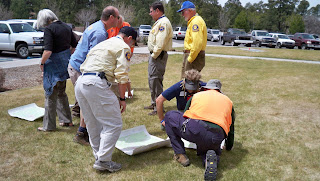
Once the students each determined true south, they were able to then orient their map (being sure to turn it so the bottom of the map was facing south, rather than turning the top—map north—toward the south by mistake.

Once oriented, they could then determine a direction of travel by placing a pen on the map, one end on their current location and other other pointing toward their destination. (In this case, the latter was a random location for demonstration purposes.) Facing the body in direction of the pen, they would then be able to walk while keeping the sun in the same location relative to their body, at least for a time (because the sun moves... or the earth does relative to it, that is).

Without gadgetry, one could use various other methods of alternative navigation in conjunction with the map to travel to a particular point, comparing actual terrain to the features on the map, using terrain handrails, catch features, check points, and so forth. The key would be knowing your current location and finding it on the map to begin with.

A little later in the class, Art discussed and then demonstrated how one can determine distance traveled, both by time and by pacing. In this photo above, students are counting paces over a distance of 100 feet, then repeating the process twice more and averaging their results. A single pace is either left-right-left=1 pace or right-left-right=1. In general, an adult takes 18 to 20 paces per 100 feet, or 1,000 paces per mile over "average" terrain. Go downhill and pace will lengthen. Uphill and pace will shorten. Of course, as Art explained, there are errors to these things, but those errors can be reigned in by using other techniques and information on the map.

One case where it would be helpful to have some kind of distance estimate would be when traveling across relatively flat, featureless terrain in the dark and the falling snow. In a scenario like that, it would be a good idea to have an idea of how far you've traveled in the event that the GPS you have malfunctioned. Some people prefer to use time to judge distance, but then you do have to account for any stops and know your average speed.

To keep track of distance by pacing, you can always keep ranger beads on a string or compass lanyard, moving one bead per 100 feet, or you can pick up a pebble or something similar every 100 feet.

So, that's a little of what went on in today's class, along with discussion about map reading, celestial navigation, and techniques for using terrain to one's advantage. This evening, the class will go out to the field to practice, taking turns using alt. nav. skills to move from point to point, partly in the daylight and then extending past dark.

Also, on other "in the news" notes, here are some links to articles about folks who are still missing and some who've finally been found:

Backpacking Light Editor Missing After A.T. Hike — An ongoing search in Virginia along the Appalachian Trail

Body of missing hiker found near Goblin Valley — About a woman who disappeared in the Canyonlands area of southern Utah five months ago

Canyon crews search for 3 missing in Colorado River — In Grand Canyon National Park (This just happened yesterday, and there's still no further news that I've found.)

And this is a REAL old one: A Mystery of the West is Solved — Remains of Everett Ruess found!

Guess What I Got (And Training & News Too)

Heh heh, a new toy! Yep, now I can be a pest and take pictures—video too—of all things SAR. (Added later: This was a bit before cell phones had good cameras or maybe any cameras.) I'm photographically challenged, but I'll do my best to add some pizazz to my babbles from here on out with some images, though I'm sure, at times, it won't be possible—or right—to take pictures while on missions. Here, look, I think I figured out how to point and shoot:


That's the team, getting ready for some training earlier today, on line search and probability of detection. We had a good turnout—15 of us, I believe, including four from mounted with their horses.


Here's how it worked:

Yesterday, our team captain and other volunteers set up the course. They put out a bunch of five-gallon buckets, all painted brown to blend in with the surroundings. These buckets were spread out among the ponderosa pine, which is fairly open terrain but still littered with forest debris, rocks, and stumps, the latter resembling the buckets (or, rather, vice versa).

Behold Nelson and a bucket...


Today, we split into teams of three or four and, team by team, determined our critical spacing. That means an object roughly the same size as what we'd be looking for (in this case, it was an identical brown bucket) was set on the ground, and each person walked away from it to the point where they could still see the bucket and identify it as a bucket. We then counted our paces from that point back to the bucket. The average of each team's results was the critical spacing used for that team's line.

Now, using critical spacing usually means each person is twice that measured distance from the next searcher. That way, if the object is exactly between two people, it could still be seen. Critical spacing is affected not only by the size of the object—which, of course, could be as big as an unresponsive person or as small as a bullet—the terrain, the amount of brush, the weather, and so forth. Given the conditions and size of the objects today, our team's critical spacing turned out to be 30 paces, or roughly 90 to 100 feet, which meant searchers could be 60 paces, or about 200 feet, apart.

Given the size of the search area, however, and the number of people in our lines, we spread out at half critical spacing, or 30 paces apart (except for the mounted folks, who went two at a time, 60 paces apart). We all had radios in order to communicate rather than shouting down the line. We'd say, "Team 1, stop" or "Team 1, start," stating our team number first because there were other teams in the field, to start and stop our lines moving forward at intervals.

This photo shows the distance between me and my next teammate in the line, while another teammate paces off to his spot further out.


So, okay, each time a team member spotted a bucket, they would stop the line without pointing to the sighted bucket and write down the GPS coordinates of their current location, the direction of the bucket from their location using positions on a clock, and then their approximate distance from that bucket.

Sometimes, when the line stopped, other team members would spot the same bucket. Other times, the line would start up again, only to be stopped one step later when someone else spotted that or a different bucket. So it was stop and go, stop and go. We didn't know until we finished how many buckets were in the field.

I know, this sounds awfully thrilling, doesn't it? But I enjoy searching, not to mention the company of my teammates, and this was like a treasure hunt to me. It was also good practice for staying in our grid, keeping an eye on the person to our right and maintaining our spacing. That's much more challenging in more variable terrain and denser brush than we had today, though.

After the exercise, we all gave our notes to our coordinator, who's going to do some calculations and explain the results at our next meeting. Until then, I'm not really sure what kind of POD information he'll give us, but I'll let you know when he does.

So that was today's event. That and playing with my new camera and getting some news. Members of our team, along with the adjoining Yavapai County SAR team and others, have been searching on and off for more than two and a half years for a plane that disappeared in the Sedona area. That plane, flown by William Westover, a private pilot from Phoenix, with his passenger Marcy Randolph, has been found in a canyon in the Secret Mountain Wilderness. Here's the article from the Arizona Daily Sun: Plane wreckage identified.

Oops! There goes my pager! Gotta run...